Showing posts with label typhoon. Show all posts

Saturday, June 16, 2012

Severe Weather Bulletin No. 7 - June 16, 2012


Severe Weather Bulletin Number SEVEN
Tropical Cyclone Alert: Typhoon "BUTCHOY" (GUCHOL)
Issued at 11:00 a.m., Saturday, 16 June 2012 

"BUTCHOY" has intensified into a typhoon and is now moving in a North Northwest direction.  
----------------------------------------------------------------------------------------

Location of Center:   470 km East Northeast of Borongan, Eastern Samar
(as of 10:00 a.m.) 

Coordinates:     13.2°N, 129.9°E 

Strength:     Maximum winds of 120 kph near the center
                  and gustiness of up to 150 kph 

Movement:      Moving North Northwest at 15 kph

Forecast Positions/Outlook:

Sunday morning:  590 km East Southeast of Casiguran, Aurora
Monday morning: 
500 km East Southeast of Basco, Batanes
Tuesday morning: 
690 km Northeast of Basco, Batanes

----------------------------------------------------------------------------------------

No Public Storm Warning Signals Raised

Typhoon "Butchoy" is expected to enhance the Southwest Monsoon that will bring rains over Luzon and Visayas especially over the western section which may trigger flashfloods and landslides.

Estimated rainfall amount is from 15 - 25 mm per hour (heavy) within the 500 km diameter of the typhoon.

Fishing boats and other small seacrafts are advised not to venture out into the seaboards of Luzon, Visayas and Eastern Mindanao due to the big waves generated by the effects combined effects of Typhoon "BUTCHOY" and the Southwest Monsoon.

The public and the disaster coordinating councils concerned are advised to take appropriate actions and watch for the next bulletin to be issued at 11 PM today.  

------------------------------------------------------------------------------------------------------------------
PAGASA-DOST | June 16, 2012 | Article Link

Sunday, October 18, 2009

Philippine 24-Hour Public Weather Forecast October 18,2009


Issued at: 5:00 a.m., 18 October 2009
Valid beginning: 5:00 a.m. today until 5:00 a.m. tomorrow

Synopsis:

At 2:00 am today, Typhoon "RAMIL" (LUPIT) {0920} was located based on satellite and surface data at 970 kms East of Casiguran, Aurora (16.8°N 132.5°E) with maximum sustained winds of 160 kph near the center and gustiness of up to 195 kph. It is forecast to move Northwest slowly.

Forecast:

Bicol Region, Visayas and Mindanao will experience mostly cloudy skies with scattered rainshowers and thunderstorms. The rest of the country will have partly cloudy to cloudy skies with isolated rainshowers or thunderstorms.

Light to moderate winds blowing from the Northwest to West will prevail over Luzon and coming from the Southwest to West over the rest of the country. The coastal waters throughout the archipelago will be slight to moderate except during thunderstorms.

___________

PAG-ASA-DOST

Ramil intensifies into typhoon, early evacuation urged

10/17/2009 | 09:15 AM

After entering Philippine territory, tropical cyclone "Ramil" (international code name “Lupit") intensified into a typhoon, but may not directly affect the country until Sunday.

But this early, the Philippine Atmospheric Geophysical and Astronomical Services Administration (Pagasa) warned residents in Northern and Central Luzon to voluntarily evacuate early.

“Yun na nga, uulit-ulitin na naman namin (sasabihan) ang naninirahan
sa paanan ng bundok, mag-evacuate [nang maaga] (We have to repeat our
advise to those living near mountain slopes to evacuate early)," Pagasa head Prisco Nilo said in an interview on dzRH radio.
'Ramil' Watch
At 2:00 a.m. Saturday, typhoon "Ramil" was located based on satellite and surface data at 850 kms East of Virac, Catanduanes (14.6°N 133.2°E) with maximum sustained winds of 120 kph and gustiness of up to 150 kph. It is moving West Northwest at 20 kph.


“Imposibleng gawin ng pamahalaan na isa-isahin ang paglilikas. Ang kababayan doon sa areas na delikado sila mismo lumikas para maiwasan ang pagkaroon ng pagkasawi sa buhay (It will be impossible for government to individually evacuate people in so short a time. If you live near a high-risk area, please evacuate to prevent loss of life)," he added.

He said it is still too early to say where “Ramil" will head, saying it may be northern Luzon or Central Luzon. A third possibility is that the typhoon will head towards Taiwan.

Either way, he said “Ramil" will bring much rain to the areas it will pass. If it passes central Luzon, it may bring rains to Metro Manila, he added.

“Ang areas na dadaanan ng bagyo dadanas ng malakas na ulan. Kung tatama sa Central Luzon, aabutin tayo sa Metro Manila ng malakas na ulan (Areas where ‘Ramil’ will pass will experience heavy rains. So if it goes to Central Luzon, Metro Manila can expect much rain)," he
said.

For its part, the Philippine Coast Guard said it is on alert in the areas expected to be affected.

Coast Guard commandant Admiral Wilfredo Tamayo said going on alert is “automatic" for them, especially in the wake of recent killer tropical cyclones “Ondoy" (Ketsana) and “Pepeng" (Parma).

“Kahit LPA pa lang naghahanda ang ating tauhan sa Coast Guard (Even when it was still a low-pressure area we are already preparing)," Tamayo said in an interview on dzBB radio.

He said the Coast Guard will be on heightened alert in areas under Signal No. 1, and full alert in areas under Signal No. 2.

As of 2 a.m. Saturday, Pagasa said “Ramil" was estimated at 850 kms east of Virac, Catanduanes with maximum sustained winds of 120 kph and gustiness of up to 150 kph and is moving west-northwest at 20 kph.

In its 5 a.m. bulletin Saturday, Pagasa said “Ramil" continues to move towards northern and central Luzon.

“Bicol Region and the Eastern sections of Visayas and Mindanao will experience mostly cloudy skies with scattered rainshowers and thunderstorms. The rest of the country will have partly cloudy to cloudy skies with isolated rainshowers or thunderstorms," it said.

But in its 11 p.m. advisory Friday that “Ramil" is not due to directly affect any part of the country “within the next 36 hours."

Pagasa’s 11 p.m. advisory forecast it to be 580 kms east-northeast of Virac, Catanduanes Saturday evening, and 420 kms northeast of Virac, Catanduanes Sunday evening.

By Monday evening it forecast “Ramil" to be 380 kms east of Casiguran, Aurora.

Meanwhile, Pagasa said light to moderate winds blowing from the southwest and southeast will prevail over Luzon and coming from the southwest and west over the rest of the country.

Coastal waters throughout the archipelago will be slight to moderate except during thunderstorms.
________
GMANews.TV

Saturday, October 17, 2009

Philippine 24-Hour Public Weather Forecast October 16,2009


Issued at: 5:00 p.m., 16 October 2009
Valid beginning: 5:00 p.m. today until 5:00 p.m. tomorrow


Synopsis:

At 2:00 p.m. today, Tropical Storm (LUPIT) {0920} was located at 1,130 kms East of Bicol Region (14.0°N 136.0°E) with maximum sustained winds of 95 kph near the center and gustiness of up to 120 kph. It is moving West Northwest at 32 kph. Intertropical Convergence Zone (ITCZ) affecting Luzon.

Forecast:

Luzon will experience mostly cloudy skies with scattered rainshowers and thunderstorms. The rest of the country will be partly cloudy to cloudy with isolated rainshowers or thunderstorms.

Light to moderate winds coming from the Southwest to Southeast will prevail over Luzon and coming from the Southwest and West over the rest of the country. The coastal waters throughout the archipelago will be slight to moderate except during thunderstorms.

_____

PAG-ASA/DOST

Friday, October 09, 2009

Philippine mudslides, floods kill estimated 100

By TERESA CEROJANO, Associated Press Writer

MANILA, Philippines – Dozens of landslides in the rain-soaked mountains of the northern Philippines killed an estimated 100 people, as a lingering storm and excess water from dams turned a portion of one province into "one big river," officials said Friday.

The latest calamity brought the death toll to more than 400 from the Philippines' worst flooding in 40 years after back-to-back storms started pounding the country's north Sept. 26.

About 100 people were feared dead in landslides in two provinces — Benguet and Mountain — along the Cordillera mountain range, about 125 miles (200 kilometers) north of Manila, said Olive Luces, regional Office of Civil Defense director.

Landslides blocked the roads to the mountain city of Baguio in the heart of the Cordillera region and exact figures were hard to get.

"We are still accounting, but all in all our estimate is there were about 100 dead in the four major landslides," Luces said. "Retrieval operations are ongoing."

About 100 landslides have struck the region since the weekend, said Rex Manuel, another relief official.

Seventeen bodies have been recovered so far from Kibungan village in Benguet's La Trinidad township, which was almost entirely buried in mud and debris late Thursday, Manuel said. Up to 40 villagers were estimated to have died, while more than 100 were moved to safety, he said.

In Buyagan village, also in La Trinidad, only three out of about 100 houses remained visible after Thursday night's landslide buried most structures there. Some 50 residents were saved but it was not clear how many died, Manuel said.

In neighboring Mountain Province's Tadian township, at least 28 people were reported missing and several bodies were recovered after the side of a mountain collapsed.

Another landslide hit a second village in Tadian early Friday. No immediate casualty reports were available.

Forecasters said Tropical Depression Parma was still lingering off the northeastern coast for more than a week, dumping rains overnight. It was the second major storm to hit the country in two weeks.

Thousands of residents of Pangasinan province, about 105 miles (170 kilometers) north of Manila, fled to rooftops and scrambled for safety after dams released excess water from recent heavy rains.

Pangasinan provincial Vice Gov. Marlyn Primicias said she was getting frantic text messages from residents asking to be rescued, adding: "Eastern Pangasinan has become one big river."

Heavy rains, plus water discharged late Thursday night from a dam in Pangasinan, inundated 30 out of 46 towns along the Agno River in the coastal province, said Boots Velasco, the province's information officer.

"There was really heavy rain, so water had to be released from the dam, otherwise it would have been more dangerous," said the government's chief forecaster Nathaniel Cruz. "Even our office was flooded and our staff had to move to the rooftop. It's near the river that they were monitoring."

Heavy army trucks could not penetrate the area, and Primicias appealed for helicopters and boats to move people out of danger.

Mayor Nonato Abrenica of the Pangasinan's Villasis township said rain and water released from a nearby dam caused floods to rise quickly, isolating his town. He asked for food, water and medicines to be airlifted and for boats to rescue stranded residents.

The government's disaster relief agency said it had requested that the U.S. Embassy redeploy hundreds of American troops from the massive cleanup in and around the capital, Manila, to the flood-hit areas in the north.

Two U.S. Navy ships were positioning in the Lingayen Gulf in Pangasinan to provide helicopters and rubber boats for the rescue mission in the province, said U.S. Marine Capt. Jorge Escatell. ___

Associated Press writers Hrvoje Hranjski and Oliver Teves in Manila and Mari Yamaguchi in Tokyo contributed to this report.

Yahoo News

Fresh flooding hits Philippines after days of rain

MANILA, Philippines – Officials say fresh flooding has hit about 30 towns in the northern Philippines, sending residents fleeing to rooftops and scrambling for safety. The floods came after dams released excess water from recent heavy rains.

Pangasinan provincial Vice Governor Marlyn Premicias said Friday that she was getting frantic text messages from residents asking to be rescued. The San Roque dam released water along the Agno River on Thursday night, inundating 30 out of 46 towns in the coastal province.

Forecasters say Tropical Depression Parma is still lingering off the northeastern coast, dumping rains overnight. It's the second major storm to hit the country in two weeks. Storms and flooding have killed more than 300 people since Sept. 26.

Associated Press

____

Yahoo News

Sunday, October 04, 2009

Philippine 24-Hour Public Weather Forecast October 4,2009


Issued at: 5:00 a.m., 04 October 2009
Valid beginnning: 5:00 a.m. today until 5:00 a.m. tomorrow


Synopsis:

At 4:00 am today, Typhoon "PEPENG" {PARMA} was located based on satellite and surface data at 70 kms North of Laoag City (18.9°N 120.5°E) with maximum sustained winds of 120 kph and gustiness of up to 150 kph. It is forecast to move West Northwest at 9 kph.

Forecast:

Extreme Northern Luzon and the provinces of Ilocos Sur and Abra will experience stormy weather while the rest of Northern Luzon will have rains and gusty winds with moderate to rough seas. The rest of Luzon will be cloudy with scattered rainshowers and thunderstorms while the rest of the country will experience partly cloudy to cloudy skies with isolated rainshowers or thunderstorms.

Moderate to strong winds blowing from the southwest will prevail over the rest of the country with moderate to rough seas.

____

PAGASA-DOST

Latest typhoon kills 4 in Philippines, churns away

By JIM GOMEZ, Associated Press Writer

MANILA, Philippines — The Philippines military rushed Sunday toward villages cut off by floodwaters from Asia's latest deadly storm, which killed at least four across the northern part of the country but spared the capital.

Typhoon Parma was churning through the South China Sea as troops in southern Taiwan helped to evacuate villages that could be hit next. The Central Weather Bureau said Parma should miss the island, but it could still bring heavy rain to flood- and landslide-prone areas still recovering from a deadly typhoon in August.

Tens of thousands of Filipinos fled to higher ground as Parma bore down on the main island of Luzon just eight days after an earlier storm left Manila awash in the worst flooding in four decades, killing almost 300 people.

Winds of 108 mph (175 kph) battered towns in half a dozen provinces, and downpours swelled rivers to bursting, officials said.

In Isabela province, one man drowned and another died from exposure to the cold and wet weather, said Lt. Col. Loreto Magundayao of an army division based there.

The National Disaster Coordinating Council said another two people died in eastern Camarines Sur, as one man fell from a roof and a 2-year-old boy drowned.

About 14 villages at the mouth of the Cagayan River were flooded when a seawall collapsed, forcing some residents to clamber onto their roofs, the mayor of nearby Aparri town told The Associated Press.

"A few of these floods were at roof level," he said. "Some people were on roofs and some of them were evacuated last night, but the rescuers were not able to reach others immediately."

The navy was bringing rubber boats to try to rescue people still stranded, he said.

Power, phone lines and internet links were down across the north, making it difficult to get reports about the extent of damage, Armand Araneta, a civil defense official responsible for several northern provinces, told the AP.

"We really got the brunt of the wind," he said by phone from Tuguegarao city, capital of Cagayan province. "Many trees fell here. The winds knocked down cables, telephone lines — even our windows got shattered by the strong winds."

Manila escaped the worst of the storm. On Sept. 26, Tropical Storm Ketsana killed at least 288 people and damaged the homes of 3 million. Ketsana went on to kill 99 in Vietnam, 14 in Cambodia and 16 in Laos.

Parma was part of more than a week of destruction in the Asia-Pacific region: an earthquake Wednesday in Indonesia, a tsunami Tuesday in the Samoan islands, and Ketsana.

Another typhoon, Melor, was churning Sunday in the Philippine Sea, 1,600 miles (2,575 kilometers) to the east.

___

Associated Press writers Oliver Teves in Manila and Debby Wu in Taipei, Taiwan, contributed to this report.

Yahoo News

Saturday, October 03, 2009

Typhoon weakens slightly as Philippines braces

By ROHAN SULLIVAN, Associated Press Writer

MANILA, Philippines – Filipinos braced Saturday for their second typhoon in eight days, though the storm weakened just hours before it was due to hit and the threat of another disaster in the flood-soaked capital eased.

Better news for the Philippines was bad news for Taiwan, which issued a storm warning and began evacuating villages in the south as Typhoon Parma headed more sharply north toward the island.

Parma was dropping heavy rain across the Philippines' main island of Luzon on Saturday including many areas still recovering from a Sept. 26 storm that inundated large parts of Manila and killed almost 300 people.

But the storm was pushed farther north overnight Friday, and Manila was no longer at risk of a new deluge, said chief government forecaster Nathaniel Cruz. The storm's sustained winds also eased slightly, to 108 mph (175 kph), down from 121 mph (195 kph) on Friday.

"It is good news, especially for those whose houses are still under water," Cruz said at a briefing Saturday morning. "But 175 (kph winds) can still uproot trees and destroy houses and blown down roofs."

Parma was due to strike the Philippines' northeastern tip on Saturday night, instead of hitting north-central Luzon on Saturday afternoon, as earlier forecast.

The danger was easing in provinces south of the capital. In Albay province, governor Joey Salceda said he had ordered more than 76,000 people who had been evacuated from their homes in the past few days to be sent home.

Tens of thousands of others were still huddled in relief shelters or with friends after President Gloria Macapagal Arroyo ordered people in flood- and landslide-prone areas in six provinces to be evacuated.

A nationwide "state of calamity" ordered by Arroyo was still in place, designed to let authorities respond quickly if another disaster occurs.

Typhoon Ketsana on Sept. 26 caused the worst flooding in 40 years across the northern Philippines, damaging the homes of more than 2 million people. The Philippines National Disaster Coordinating Council on Saturday lowered the death toll from the Ketsana storm by five to 288.

Ketsana went on to hit other Southeast Asian countries, killing 99 in Vietnam, 14 in Cambodia and 16 in Laos.

It was part of more than a week of destruction in the Asia-Pacific region that has claimed more than 1,500 lives so far: an earthquake Wednesday in Indonesia; a tsunami Tuesday in the Samoan islands; and Typhoon Ketsana across Southeast Asia.

Many places in Manila are still chest-deep in water, or covered in thick mud and garbage.

In Quezon City, residents turned from cleaning up after Ketsana to trying to secure their belongings from the risk of more flooding.

"We do not know what to do or where we can go," said resident Bebang De Los Santos. "We don't have a way out and this is the only place that is safe, but we don't have any shelter."

Taiwan's Central Weather Bureau issued a storm warning for Parma on Saturday. This prompted officials to start evacuating villages in the southern county of Kaohsiung, where a typhoon in August triggered flash flooding that killed about 700, said local official Lin Chun-chieh.

One danger in Manila was posed by Lake Laguna, which rose more than 3.3 feet (one meter) as Ketsana passed and was in danger of spilling over into districts housing some 100,000 people if there is much more rain, said Ed Manda, general manager of the Laguna Lake Development Authority.

___

Associated Press writers Oliver Teves in Manila and Debby Wu in Taipei, Taiwan, contributed to this report.

link here

Thursday, October 01, 2009

Philippine 24-Hour Public Weather Forecast October 1,2009

Issued at: 5:00 a.m., 01 October 2009
Valid beginning: 5:00 a.m. today until 5:00 a.m. tomorrow


Synopsis:

At 4:00 a.m. today, Typhoon "PEPENG" {PARMA} was estimated based on satellite and surface data at 650 kms East of Borongan, Eastern Samar (11.5°N, 132.1°E) with maximum sustained winds of 150 kph and gustiness of up to 185 kph. It is forecast to move West Northwest at 24 kph.

Forecast:

The eastern section of the country will experience cloudy skies with scattered rainshowers and thunderstorms becoming widespread rains over Bicol region which may trigger flashfloods and landslides. The rest of Visayas and Mindanao will have mostly cloudy skies with scattered rainshowers and thunderstorms. The rest of Luzon will be partly cloudy to cloudy with isolated rainshowers or thunderstorms.

Moderate to strong winds blowing from the northeast to northwest will prevail over Eastern Luzon, Visayas and Mindanao and coming from the southwest and south over the rest of the country. The coastal waters throughout the archipelago will be moderate to rough.

Wednesday, September 30, 2009

Typhoon Ondoy Disaster

Disaster Map of Rescue, Road Conditions, and Relied Centers

The interactive map contains road conditions, the status of flooded areas, and the locations of relief centers, in addition to the original data set of stranded people needing rescue in calamity areas.

GMANews.TV staff and volunteers have spent the better part of the last 72 hours harvesting the information from TV, radio, social media and callers and web users who have contacted us; and then pinpointing precise locations on the map.

Click Here for the Disaster Map
For Help on how to use the Disaster Map

Missing Persons Database

Do you have a relative, friend, classmate, workmate, neighbor, or acquaintance that went missing during the chaotic weekend of Sept. 26-27 as storm “Ondoy" wreaked havoc on Metro Manila and the rest of Luzon?

Or maybe you happen to be in touch with Ondoy-displaced or stranded people in the process of rescue, evacuation and relief operations, and you want to send word that they are safe and sound?

There is now an interactive “missing-persons" database (MPD) being maintained by GMANews.Tv. This resource can help close the information gap between those who are looking for missing persons, and those persons themselves, or people who know their whereabouts and condition.

Click here to view the Missing Persons Database
Click here to file a Report or Inquiry on a Missing of Found Person
Click here for instructions on how to use the database

Wife recalls Cpl Regua's heroism

Official Philippine Army Press Release

Date Released: 29 Sep 2009


Being one of the first who responded to the flood-stricken areas in Sitio Johnson, Brgy. Nanguma, Mabitac, Laguna, the Philippine Army suffered six casualties from the disaster response team who went to the area. Among those who offered their lives is Corporal (Cpl) Adriano Regua, the detachment commander of the response team, together with five of the Civilian Armed Forces Geographical Unit Active Auxiliary (CAA) in his team.

According to reports, Cpl Regua's family and home in Tanay, Rizal were also suffering the rampaging floods of "Ondoy" as he was saving lives in Mabitac, Laguna. Fortunately, as Philippine Army response teams also responded quickly, his wife and two daughters were brought to safer grounds. "Habang may nililigtas siyang ibang tao, ibang sundalo ang tumulong sa amin na pamilya niya," his wife recounts.

Reaching safety late last Saturday, his wife also sent a text message saying "Buti na lang ligtas tayong lahat," unaware of the tragedy her husband faced. It was reported that Cpl Regua died in an attempt at rescuing one of his men from being swept away by the current but, in the end, both of them were carried away by the strong flood, drowning them. This feat proves how responsible a leader Cpl Regua is to his men. Also, as the detachment commander of his group, he led his team well, as they were able to save 200 residents in the area alone even at the cost of their own lives. His remains, along with his five CAA members', were recovered the next day at around 9:30 am along Manila East Road in the same area.

Cpl Regua's wife could not help but mourn over her husband's death. But, along with the rest of the country, she shall forever see Cpl Regua as a hero and a leader who selflessly offered his life in service of the citizens and his men. "Ang kunswelo ko lang, namatay siya na nagseserbisyo. Iyon naman talaga ang gusto niya e," she ends.

Philippine 24-Hour Public Weather Forecast


Issued at: 5:00 a.m., 30 September 2009
Valid beginning: 5:00 a.m. today until 5:00 a.m. tomorrow


Synopsis:
At 2:00 a.m. today, Tropical Storm {PARMA}(0917) was estimated based on satellite and surface data at 1,110 kms East of Mindanao (8.0°N, 137.3°E) with maximum sustained winds of 75 kph and gustiness of up to 90 kph. It is forecast to move West Northwest at 19 kph.


Forecast:
Extreme Northern Luzon, Eastern Visayas and Eastern Mindanao will experience mostly cloudy skies with scattered rainshowers and thunderstorms. The rest of the country will have partly cloudy to cloudy skies with isolated rainshowers or thunderstorms.

Moderate to strong winds blowing from the southwest to south will prevail over the western section of Luzon with moderate to rough seas. Moderate winds blowing from the south to southeast will prevail over the rest of Luzon and coming from the south to southwest over the rest of the country with moderate seas.


PAGASA-DOST
Government of the Philippines

Tuesday, September 29, 2009

Philippine Floods: Why Wasn't Manila Prepared?

By ISHAAN THAROOR Ishaan Tharoor – 30 mins ago

http://news.yahoo.com/s/time/20090929/wl_time/08599192664600


In Manila, millions of residents now live in a world of mud. Torrential rain over the weekend triggered the worst flooding the Philippines' capital has seen in over four decades, submerging more than 80% of the city, killing at least 246 people and displacing hundreds of thousands more. By Tuesday, the water had receded in many places, but it left behind ruined homes and swept-away neighborhoods, and according to health officials, it disabled the majority of Manila's medical facilities. Debris, sewage and abandoned vehicles that were tossed around by gushing currents now litter the notoriously polluted capital; aid workers warn of water-borne diseases. The government has placed the area around Manila under a "state of public calamity."

In an appeal for assistance, Philippine President Gloria Macapagal-Arroyo described Tropical Storm Ketsana, which hit Manila on Sept. 26, as a "once-in-a-lifetime typhoon." A month's worth of rain deluged the city in the space of 12 hours. "The system is overwhelmed, local government units are overwhelmed," said Anthony Golez of the state's National Disaster Coordinating Council at a press conference on Sept. 28. (See pictures of the storm.)

Yet many in the country are pointing fingers at its politicians for failing to predict the scale of the disaster or lessen the damage it caused. Manila, they say, was always bound to face such catastrophe, and more should have been done to help its millions of residents prepare. A recently published study by the Economy and Environment Program for Southeast Asia (EEPSA), a research group based in Singapore, ranked metropolitan Manila as one of the provinces in Southeast Asia most vulnerable to flooding. The capital region is perched on a marshy isthmus that is crisscrossed with streams and rivers. An ever-growing population - Manila is now a sprawling mega-city of some 12 million people, larger still when factoring in the day-worker population - and the lack of infrastructure to accommodate it left swaths of the city exposed. "What we are seeing is a phenomenon that will affect many major cities in Asia," says Neeraj Jain, country specialist for the Philippines at the Asian Development Bank (ADB), which is headquartered in Manila. "Urbanization has been so rapid, yet the planning processes have lagged." (Read "Manila Through the Eyes of F. Sionil Jos[a {e}].")

Last weekend's flood was in large part the result of the capital's poor drainage and sanitation systems, which have been neglected by several successive administrations in power. As Ketsana rained down upon Manila, sewers that were clogged up by plastic bags and other refuse led to roads becoming rivers and gardens lagoons. Video images of desperate people riding floating pontoons of garbage down inundated streets were a sign not just of the consequences of the flood, but also its causes. Many impoverished Manila residents live in makeshift settlements by rivers and creeks - the source of their drinking water - that overflowed and carried off their homes. "People have always been living on the edge," says Carlos Celdran, a popular Manila historian and performing artist. "It's amazing the city has actually managed to make it this far."

The Spanish seized Manila from its Muslim rulers in the 16th century and set it up as their colonial seat in Asia. The city was a flourishing, elegant entrepÔt for centuries, but in recent times civic planning has been more haphazard as the population has boomed. Lambert Ramirez, executive director of the National Institute for Policy Studies, a Manila-based think tank, says much of the blame for poor urban management ought to be leveled at the government. "There's no coordinated policy for cleaning up garbage. There's no political will to get even simple things done," he says. Ramirez spoke to TIME while salvaging appliances and valuables from his own flooded home. (See pictures of the recent floods in Georgia.)

Jain of the ADB says the leadership in Manila, faced with elections in the coming months, is indeed thinking of long-term solutions to its infrastructure woes. Plans have been afoot to improve sanitation and also relieve the population burden in metro Manila by shifting certain businesses and government offices to areas outside the dense capital region. But the challenge facing the Philippines and other poor Asian countries is one of resources. Most Southeast Asia nations budget around 2% or 3% of their GDP for infrastructure development. To fend off such disasters in the future, Jain says that figure ought to be closer to 5% or 6%. It's a deficit that few governments can afford to make up overnight.

But given the looming specter of climate change, they may have to find a way sooner rather than later. The prospect of another typhoon this week underscores environmentalists' concern that shifts in global temperatures may mean increasingly extreme weather patterns for coastal cities like Manila. "[Ketsana] was a startling, unique event," says Herminia Francisco of the EEPSA in Singapore. "But then I think this is going to happen more and more frequently in the future." (See a TIME graphic on destructive weather.)

For today, as international aid pours in from organizations like the Red Cross and the World Food Program, Manila residents are slowly retrieving their homes and livelihoods from the mud. Thousands of volunteers have donated food and rushed to help those who were worse affected. "Filipinos are used to crisis," says Celdran. "We've gone through a lot over the years, but we've managed. We're a resilient people."

Monday, September 28, 2009

Arroyo opens Malacañang for ‘Ondoy’ relief ops

09/28/2009 | 03:59 PM

In the wake of rescue and relief efforts for the victims of tropical storm "Ondoy," President Gloria Macapagal Arroyo on Monday opened the doors of Malacañang Palace for the setting up of a relief operations center.

"The President (said) na gawing sentro ng relief operations ang Malacañang, even if kailangan mag-move out ng First Family dito," Press Secretary Cerge Remonde said in an interview on dzBB radio.

(The President said that Malacañang be the center of relief operations, even if the First Family had to move out.)

A separate radio report said the center would help government agencies pitch in their efforts for faster coordination of their services to the storm’s victims.

The report added that Executive Secretary Eduardo Ermita and Remonde were finalizing plans for the installation of an emergency assistance center at the Palace.

Ondoy battered Metro Manila and the Central Luzon and Calabarzon regions on Saturday – its torrential rains left thousands displaced and about a hundred dead, as of Monday noon.

On Sunday, President Arroyo visited the Ortigas Extension in Pasig City to extend her sympathies to the flood victims in the affected area. She later went to Arayat town in Pampanga to commiserate with the victims in her home province.

The radio report said that on Monday, Mrs. Arroyo went to Marilao, Bulacan to distribute relief goods. Her trip was cut short due to strong rains.

The Philippine Atmospheric, Geophysical and Astronomical Services Administration (Pagasa) said Ondoy will continue to enhance the southwest monsoon and bring occasional rains over the western sections of Central and Southern Luzon on Monday. - Sophia Dedace, GMANews.TV

http://www.gmanews.tv/story/173321/arroyo-opens-malacantildeang-for-ondoy-relief-ops

Pagasa: 2 more tropical depressions may hit RP this week

09/28/2009 | 10:11 AM

Barely had Luzon recovered from the destruction wrought by tropical storm "Ondoy," a state weather forecaster on Monday said two tropical depressions threaten to enter the country later this week.

In an interview on dwIZ radio, Philippine Atmospheric Geophysical and Astronomical Services Administration (Pagasa) forecaster Connie Dadivas said the two weather disturbances are likely to enter Philippine territory late Wednesday or Thursday.

"May dalawang tropical depression sa labas ng Philippine area of responsibility. Ine-expect natin na papasok sa bansa, papasok ito sa boundary by Wednesday hapon or Thursday (We see two tropical depressions outside the Philippine area of responsibility. We expect them to enter Philippine boundary by late Wednesday or Thursday)," Dadivas said.

But another Pagasa forecaster Joel Jesusa, in a separate radio interview, said the two LPAs are still far away to affect any part of the country for now.

"Malayo pa po, sobrang layo pa ang binabanggit nating dalawang LPA, 1,000 km pa ito (The two LPAs are still too far away, they are about 1,000 km away)," he said on dzXL radio. He added that the two LPAs were moving west-northwest as of Monday.

Earlier, Pagasa said Ondoy continued to move farther away from the country Sunday night, and was 560 kilometers west of Iba, Zambales as of 10 p.m. Sunday.

It packed maximum winds of 110 kilometers-per-hour (kph) near the center and gustiness of up to 140 kph, and was moving west-northwest at 17 kph.

However, Pagasa said Ondoy will continue to enhance the southwest monsoon and bring occasional rains over the western sections of Central and Southern Luzon.

"Luzon will experience cloudy skies with scattered rainshowers and thunderstorms while Visayas and Mindanao will have mostly cloudy skies with scattered rainshowers and thunderstorms," Pagasa said in its 5 a.m. bulletin Monday.

Ondoy struck Luzon on Saturday, bringing epic proportions of floodwater in Metro Manila and other parts of Luzon. [See: Epic flood in Metro Manila caused by record rainfall]

As of 6 a.m. Monday, the death toll from Ondoy has reached 86 based on the tally by the National Disaster Coordinating Council (NDCC). The figure, however, does not include 12 reported deaths in Antipolo City, 29 in Quezon City, and 58 in Marikina City as announced by Defense Secretary Gilberto Teodoro Jr. [See: Death toll from storm 'Ondoy' continues to rise - NDCC] - GMANews.TV

http://www.gmanews.tv/story/173302/pagasa-2-more-tropical-depressions-may-hit-rp-this-week

Death toll from storm 'Ondoy' continues to rise - NDCC

09/28/2009 | 07:59 AM

The death toll from tropical storm "Ondoy" (international name Ketsana) rose to 86 as of early Monday morning, but may go much higher as authorities verify reports of more deaths caused by the cyclone.

As of 6 a.m., the National Disaster Coordinating Council (NDCC) also shifted the focus of its efforts from search-and-rescue to relief work.

"Right now we will concentrate really on providing food and other necessities," NDCC chairman and Defense Secretary Gilberto Teodoro Jr. said at the NDCC's 6 a.m. briefing.

Teodoro said that as of 6 a.m. Monday, NDCC figures showed "Ondoy" had affected 86,313 families or 435,646 people. Of these, 23,126 families or 115,890 people were brought to 204 evacuation centers.

Ondoy struck Luzon on Saturday, bringing epic proportions of floodwater in Metro Manila and other parts of Luzon. [See: Epic flood in Metro Manila caused by record rainfall]

The death toll rose to at least 86, including seven in Metro Manila, 22 in Central Luzon, and 56 in Southern Luzon. Of the fatalities, five were military personnel trying to rescue residents affected by a landslide in Laguna province.

But Teodoro said the 86 does not include 12 reported deaths in Antipolo City, 29 in Quezon City, and 58 in Marikina City. At least 32 people remained missing, he added.

Damage to property was initially reported at P60 million, including P41.1 million in damage to infrastructure, P19.2 million in damage to schools, and P212,000 in damage to agriculture.

Blue alert

Meanwhile, dzBB reported the Department of Health placed all public hospitals placed on blue alert, meaning all medical personnel are to be on duty 24 hours a day.

Also, the DOH had medical personnel prepare anti-tetanus shots.

On the other hand, the Private Hospitals Association of the Philippines (PHAP) said at least 50 of its members in Metro Manila and Luzon were affected in Tanay and the cities of Marikina, Muntinlupa, Las Piñas and Parañaque.

"Baka mag-advance sila ng payment sa future claims namin para makabawi... para makaserbisyo (We hope PhilHealth can advance payments for our future claims so we can continue operating)," PHAP president Rustico Jimenez said on dzBB radio.

Also in Manila, the US Embassy said some of its units would be closed for Monday, including those for visa appointment.

In Pasig City, vendors at the Mutya ng Pasig market had to move their stalls to the nearby church, according to a report by dzBB’s Manny Vargas. - GMANews.TV

http://www.gmanews.tv/story/173297/death-toll-from-storm-ondoy-continues-to-rise-ndcc

Wednesday, November 28, 2007

Storms Lando, Mina and Nonoy: 3 Typhoons set to lash on RP


MANILA, NOVEMBER 27, 2007 (STAR) THE FREEMAN - By Jasmin R. Uy, Staff

The Philippine Atmospheric, Geophysical, Astronomical Services
Administration (PAGASA) said that more bad weather will be experienced
around the country as three tropical storms continue to linger around
the Philippines Area of Responsibility.

PAGASA-Mactan Chief Oscar Tabada said the meeting of the three
weather disturbances — typhoon Mina, tropical storm Lando, and a low pressure
area that might develop into a tropical depression named Nonoy – may
happen on Thursday.

Tabada said tropical storm Lando has been pulled back by Typhoon Mina
which is why it is expected to re-enter the Philippine Area of Responsibility.

Tabada explained that the attraction of “Lando” towards “Mina” is called
the “Fujiwhara effect, a case wherein a stronger weather disturbance is
affecting the lower one.

The Fujiwhara effect describes the rotation of two storms around each
other. It’s most common with tropical cyclones such as typhoons or
hurricanes, but also occurs in other cases. The effect is thought to
occur when storms get about 1,500 kilometers.

“Mina” is more dominant, she is the stronger typhoon. It’s
always like that in the Fujiwhara effect. If the dominant typhoon turns, the other
will move too. Upon crossing Northern Luzon, “Mina” is expected to
do a U-turn, and “Lando” will also move.

Lando, which exited the PAR last week, may reenter through Palawan
and Nonoy may enter the PAR through the Visayas region.Tabada said Lando
has again developed into a tropical storm, packing maximum sustained winds
of 95 kilometers per hour.

If Cebu will be on Lando’s path, Tabada said that they cannot yet
tell whether Lando will still hit the metropolis.

“Wala man nay dalan ang bagyo however, we should not feel relaxed
about it because it might hit the city,” Tabada said.

Tabada said that according to their forecast, Lando will enter
Palawan and will pass through Mindoro.

Mina on the other hand,is expected to move to the vicinity of Laoag
City, Ilocos Norte and Basco, Batanes on Tuesday morning and will be
felt in the province of Batanes until Thursday.

Nonoy on the other hand has not yet entered the PAR but is expected
to hit the country Thursday, according to the Tabada.


Mina’s Wrath

  Typhoon Mina slammed into the northeastern Philippines after killing
at least eight people in other parts of the country. Mina roared into the
coastal town of Palanan in Isabela province late Sunday, its sustained
wind weakening but remaining dangerous at 120 kilometers per hour with
gusts of up to 150 kph, chief government forecaster Nathaniel Cruz
said.After hitting land, it veered toward the country’s mountainous
northern provinces, where authorities evacuated thousands of people due
to fears of landslides.The typhoon flooded at least 50 villages in
Isabela, a province of more than a million people. A swollen river in the
provincial capital, Ilagan, engulfed at least 10 houses, whose residents fled to
safety late Sunday, officials said, adding that most of Isabela had no
power.In its report dated Monday noon, the National Disaster
Coordinating Council (NDCC) said seven of the eight fatalities were from Camarines
Sur while one was from Camarines Norte. The two missing were from Apayao
province.However, it said there are still no reports of casualties in
Cagayan Valley, where Mina made landfall before midnight Sunday. The
NDCC also said at least 30,844 families or 141,863 persons have been
evacuated to 21 evacuation centers as of Monday noon.It said these include 284
families or 1,110 persons in 14 evacuation centers in Cagayan Valley;
and 5,676 families or 28,355 persons in Catanduanes.In nearby Cagayan
province, two villagers drowned Sunday. Strong winds toppled trees and
knocked down power posts, cutting off electricity in the province of
nearly a million, Gov. Alvaro Antonio said. The province’s rice
industry suffered losses.‘’We were just one or two weeks away from harvest
time. I’m afraid we’ve lost everything to the flood and strong winds,’’
Antonio told The Associated Press by telephone.The Agriculture Department
estimated losses at over P100 million, which is just a fraction of the billions
of pesos in damages wrought by storms last year.

A landslide covered a road in the resort town of Pagudpud, in
northern Ilocos Norte province, late Sunday, blocking buses and cars, but
apparently causing no injuries. Troops were deployed to clear the road,
army Maj. Gen. Melchor Dilodilo said.Classes were suspended in several
provinces, partly because some were used to shelter evacuees, officials

said.Among the eight dead, five people drowned and another was
electrocuted over the weekend in southeastern Camarines Sur province,
Health Secretary Francisco Duque III said.Mina has been the most
erratic of the 13 typhoons and major storms that have hit the Philippines this
year. It first headed for the populous Bicol region, where more than
250,000 people were evacuated, but shifted Saturday to the north.As
authorities scrambled to shift their focus to the northern provinces of
Isabela, Aurora and Cagayan, forecasters said a typhoon that killed 14
people in the Philippines last week before heading for Vietnam had
reversed direction.— with reports from AP, GMANews.TV

Typhoon ‘Lando’ makes U-turn, lashes Palawan

By Helen Flores Tuesday, November 27, 2007
Tropical storm “Lando” (international name Hagibis) reentered the
Philippines yesterday, threatening Palawan and southern Luzon
provinces, weather forecasters said.

As a new wave of devastation looms with Lando’s return, disaster
officials spoke of ravages inflicted by typhoon “Mina” (international name
Mitag) on northeastern Luzon, particularly Isabela. Mina killed at
least eight people in the Bicol region.

Mina roared into the coastal town of Palanan in Isabela late Sunday,
its sustained winds weakening but remaining dangerous at 120 kilometers per
hour with gusts of up to 150 kph, Nathaniel Cruz, chief forecaster of
the Philippine Atmospheric, Geophysical and Astronomical Services
Administration (Pagasa) said.

The typhoon flooded at least 50 villages in Isabela, a province of
more than a million people. A swollen river in the provincial capital Ilagan
swept away at least 10 houses late Sunday and knocked off power in most
of the province.

The devastation prompted the communist New People’s Army to declare
an indefinite ceasefire in affected areas to give way to relief and rescue
operations. The military offensive against rebel groups has been suspended
since Saturday.

The ceasefire, an NPA statement said, “was a matter of policy,
whether or not the government and its armed forces issue a similar
declaration.”

Meanwhile, two villagers drowned Sunday in nearby Cagayan valley
where strong winds toppled trees and knocked down power posts. Gov. Alvaro
Antonio said the province’s rice industry suffered heavily.

“We were just one or two weeks away from harvest time. I’m afraid
we’ve lost everything to the flood and strong winds,” Antonio said.

“I’ve never experienced a typhoon this strong. My house shuddered
because of the strong winds and I thought it would crumble,” said
Janet Castillo, 26, a mother of three from Solana, Cagayan.

In Rizal, Cagayan, a woman was missing after she was swept away by
strong river currents yesterday.

In Ilocos Norte, a landslide covered a road in the resort town of
Pagudpud, blocking buses and cars but apparently causing no injuries.
Troops were deployed to clear the road, army Maj. Gen. Melchor Dilodilo
said.

Classes were suspended in several provinces, partly because some
classrooms were used to shelter evacuees, officials said.

In Pangasinan, two firemen in Sta. Maria died of electrocution while
they were installing a television antenna near the fire station at the
height of the typhoon. Fire Officer 1 Allan Wendell Bautista and FO2
Edwin Gonzales died instantly when they accidentally touched a high-tension
wire.

The eight officially listed as dead included five who drowned and
another who was electrocuted over the weekend in Camarines Sur
province, Health Secretary Francisco Duque said.

In Conner town in Apayao, Felipe and Reiner Abawag went missing after
the swollen Conner River swept away their house yesterday morning, the
Office of Civil Defense in the Cordillera said.

Mina has been the most erratic of the 13 typhoons and major storms
that have hit the Philippines this year. It first headed for the populous
Bicol region, where more than 250,000 people were evacuated, but shifted
Saturday to the north.

Pagasa director Prisco Nilo earlier said Mina pulled Lando back to
the country while the storm was on its way to Vietnam. He said the weather
phenomenon is called the “Fujiwara effect.”

Nilo said this phenomenon happens when a stronger storm directs the
movement of a weaker storm.

As of 4 p.m. yesterday, Lando continued to move east-northeast
towards northern Palawan-Mindoro area.

It was last spotted at 300 kilometers west-northwest of Puerto
Princesa City, packing winds of 75 kilometers per hour near the center and
gustiness of up to 90 kph. It was forecast to move east-northeast at 15 kph.

Storm signal no. 2 was hoisted over northern Palawan and Calamian
Group of Islands.

Signal no. 1 was up in Oriental Mindoro, Occidental Mindoro, Lubang
Island, Romblon, the rest of Palawan and Cuyo Island.

Lando is forecast to be at 140 kms west-northwest of Coron, Palawan
this afternoon; 60 kms north of Alabat, Quezon tomorrow afternoon; and at
210 kms east of Casiguran, Aurora tomorrow afternoon.

Meanwhile, as of 4 p.m. yesterday, Mina was spotted at 100 kms north
of Laoag City, packing winds of 110 kph near the center and gustiness of
up to 140 kph. It was forecast to move north-northeast at 11 kph.

Pagasa raised public storm warning signal no. 3 over Cagayan,
Kalinga, Apayao, Abra, Ilocos Norte, Babuyan Group of Islands, and the Batanes
Group of Islands.

Signal no. 2 was up in Isabela, Ifugao, Mt. Province, Benguet, La
Union, and Ilocos Sur.

Signal no. 1 was hoisted over Aurora, Quirino, Nueva Ecija, Nueva
Vizcaya, Tarlac and Pangasinan.

Meanwhile, Senate President Manuel Villar filed Senate Bill 1916
seeking to modernize Pagasa.

“We have more reasons to modernize because our country is
considered a typhoon belt, aside from the fact that we are an agriculture
country,” Villar said.

“It is highly imperative that we contemplate farmers’ welfare by
giving them accurate weather information for their own protection,” he said
in his explanatory note on the proposed measure.

Ready for Lando

The National Disaster Coordinating Council (NDCC) said it is prepared
for a new onslaught of Lando.

“We are as ready as we can be,” NDCC’s Office of Civil Defense
chief Anthony Golez told a news conference at Camp Aguinaldo.

He said that all regional and provincial disaster units in areas in
Lando’s path, especially Palawan, Mindoro, Quezon and Bicol, are on
full disaster alert. Relief goods and medical supplies have been
“pre-positioned” in critical areas ahead of Lando’s expected
landfall, said Golez.

From Palawan, “Lando would be passing Mindoro Island, the southern
portion of Quezon province and Camarines Norte,” Department of
Science and Technology Undersecretary Graciano Yumul said.

Malampaya Plant officials also assured NDCC of its readiness in the
face of Lando’s reentry.

Yumul said Lando will be over the Philippine Sea by Thursday, where
it will merge with another tropical depression Nonoy.

NDCC placed the damage left by Lando and Mina to agriculture and
infrastructure at P109.6 million.

Yumul said the typhoon knocked off the services of mobile phone
provider Smart in Palanan, Isabela, and in Diapigue, Aurora, he said.

Mina and Lando affected a total of 88,317 families or 399,033 persons
from 827 barangays in Northern and Central Luzon, Southern Tagalog and
Bicol region, according to NDCC.

There are still 30,844 evacuees in evacuation centers, the NDCC
reported.

Duque has extended to Nov. 30 the DOH measles immunization campaign
to reach out to those displaced by Lando and Mina. – Eva Visperas, Cet
Dematera, Edu Punay, Cesar Ramirez, Charlie Lagasca, Jun Elias, Sheila
Crisostomo, Manny Galvez, Christina Mendez, Jaime Laude, AP

More information on the Typhoons at:
- http://202.90.128.200/wb/tcupdate.shtml
- http://www.ssd.noaa.gov/PS/TROP/mtsatfloat1.html
- MayBagyo.com
--------------------------------------------------------------------------------
Chief News Editor: Sol Jose Vanzi

© Copyright, 2007 by PHILIPPINE HEADLINE NEWS ONLINE
All rights reserved

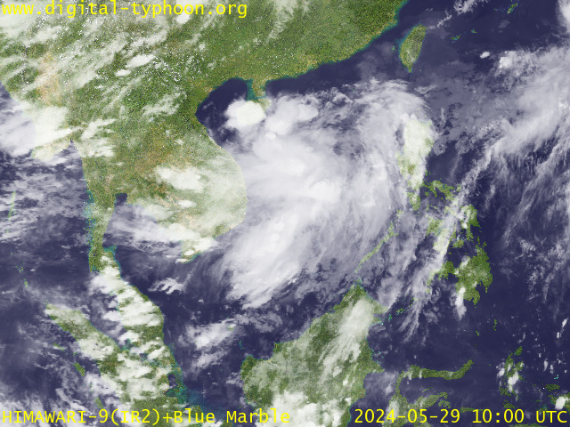
Images by Digital-typhonn.org

Featured Posts

AFP Modernization 2017: Highlights and Review

The modernization of the Armed Forces of the Philippines was on a roll this year, as we've seen a few big ticket items having completely...

Popular Posts