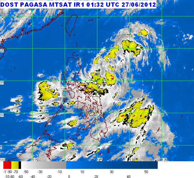
Severe Weather Bulletin Number 4
Tropical Cyclone Warning: Tropical Storm "DINDO" (DOKSURI)
Issued at 11:00 a.m., Wednesday, 27 June 2012
Tropical Cyclone Warning: Tropical Storm "DINDO" (DOKSURI)
Issued at 11:00 a.m., Wednesday, 27 June 2012
Tropical Storm "DINDO" has slightly intensified as it continues to move west Northwest towards Extreme Northern Luzon.
--------------------------------------------------------------------------
Location of Center: 380 km East Northeast of Virac, Catanduanes or
(as of 10:00 a.m.) 490 km East Southeast of Casiguran, Aurora
(as of 10:00 a.m.) 490 km East Southeast of Casiguran, Aurora
Coordinates: 15.4°N, 127.5°E
Strength:
Maximum winds of 75 kph near the center gustiness of up 90 kph
Movement:
West Northwest at 19 kph
Forecast Positions/Outlook:
Thursday morning: 220 km Northeast of Casiguran, Aurora or
210 km East Northeast of Tuguegarao, Cagayan
Friday morning: 150 km West Southwest of Basco, Batanes
Saturday morning: 530 km Northwest of Basco, Batanes
210 km East Northeast of Tuguegarao, Cagayan
Friday morning: 150 km West Southwest of Basco, Batanes
Saturday morning: 530 km Northwest of Basco, Batanes
---------------------------------------------------------------------------
Areas Having Public Storm Warning Signal
Signal No. 2 (60-100 kph winds)
- Cagayan
- Isabela
Signal No. 1 (45-60 kph winds)
- Batanes Group of Islands
- Calayan Island
- Ilocos Norte
- Apayao
- Abra
- Kalinga
- Ilocos Sur
- Mt.Province
- Aurora
- Ifugao
- Nueva Viscaya
- Quirino
Residents living in low lying and mountainous areas, under public storm
warning signal are alerted against possible flashfloods and landslides.
Estimated rainfall amount is from 15 - 25 mm per hour (heavy - intense) within the 400 km diameter of the Tropical Storm.
Tropical Storm "Dindo" is expected to enhance the Southwest Monsoon that will bring rains over Southern Luzon, Visayas and Mindanao especially the western section.
Fishing boats and other small seacrafts are advised not to venture out into the Eastern Seaboards of Central and Southern Luzon and Visayas due to the combined effect of Tropical Storm "DINDO" and the Southwest Monsoon.
The public and the disaster coordinating councils concerned are advised to take appropriate actions and watch for the next bulletin to be issued at 5 PM today.
-----------------------------------------------------------------------------------------------
PAGASA-DOST | June 27, 2012 | Article Link


No comments:
Post a Comment